
BIG Temperature Drop Later Today
Weather Update for Thursday, October 31, 2019
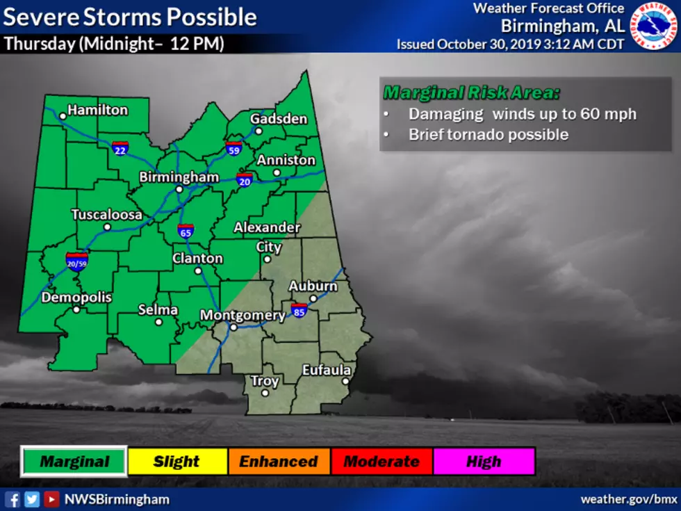
Today we start off with a 100% chance of showers and thunderstorms with a high near 62. As the day progresses, the rain and thunderstorm chance drops to 40%. We still have the potential for severe weather today, most of our listening area is under a slight risk, and the eastern counties are listed under a marginal risk. Please be mindful that wind gusts can get as high as 25 mph.
Please be prepared for the BIG temperature drop in the early evening (around 5 pm) to 47 degrees for some areas. This means it will be a cold evening for the trick or treaters, so it might be a good idea to dress in layers.
Weather Heads Up: The National Weather Service has issued a hazardous weather outlook for tonight because temperatures are expected to fall to near or just below freezing for the northern areas of Central Alabama Friday morning. Temperatures may drop to near or just below freezing for the northern areas of Central Alabama Saturday and Sunday mornings. This outlook is for the following counties: Marion-Lamar-Fayette-Winston-Walker-Blount-Etowah-Calhoun-Cherokee-Cleburne-Pickens-Tuscaloosa-Jefferson-Shelby-St. Clair-Talladega-Clay-Randolph-Sumter-Greene-Hale-Perry-Bibb-Chilton-Coosa-Tallapoosa-Chambers-Marengo-Dallas-Autauga-Lowndes-Elmore-Montgomery-Macon-Bullock-Lee-Russell-Pike-Barbour.
Enjoy your Halloween! Be sure to follow me on Twitter at @MaryKRadio
More From ME TV FM 97.5