
Potential For Severe Thunderstorms Later Today
Potential For Severe Thunderstorms Later Today
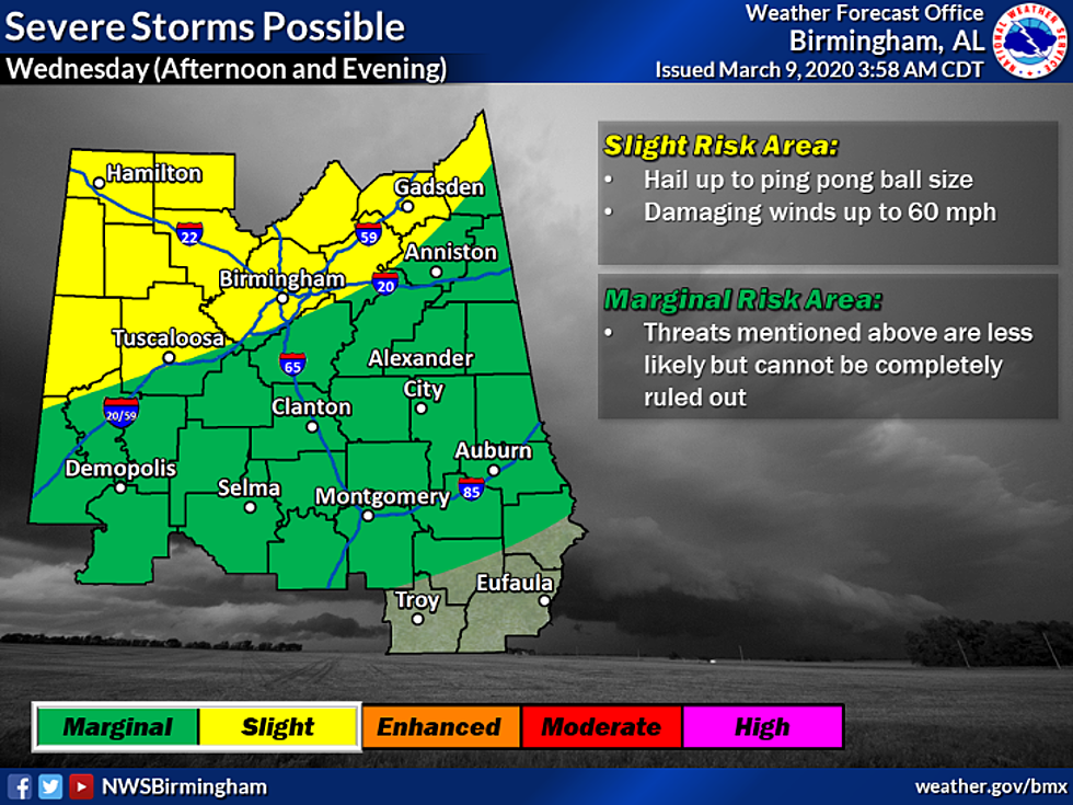
For today (Wednesday, March 11, 2020), there is the potential for isolated severe thunderstorms with the timeline to occur between 1 pm until 10 pm. A detailed timeline is that storms should enter the Northwest around 1 pm, then storms will move towards Tuscaloosa around 4 pm, and will move towards the East around 6 pm. According to the National Weather Service has issued a Hazardous Weather Outlook with “the primary threats include damaging winds up to 60 MPH and hail up to quarter size.” As of right now, these storms could affect the western two-thirds of Central Alabama. The Storm Prediction Center has West Alabama under a “slight risk” category as well. Please be sure to stay weather aware as damaging winds could be significant this afternoon into the evening. Also, while your community this morning, there is the possibility of fog until 9 am Wednesday that will only give us visibility below one mile.

More From ME TV FM 97.5