Rain For Today With Severe Storms Possible At Midnight
Weather Update for Wednesday, October 30, 2019
Today the high will be near 74 with a 100% chance of showers and thunderstorms. There is also the possibility of wind gusts as high as 35 mph. Tonight, the low will be near 64 with a 90% chance of showers and thunderstorms. The rain will be widespread across the state of Alabama.
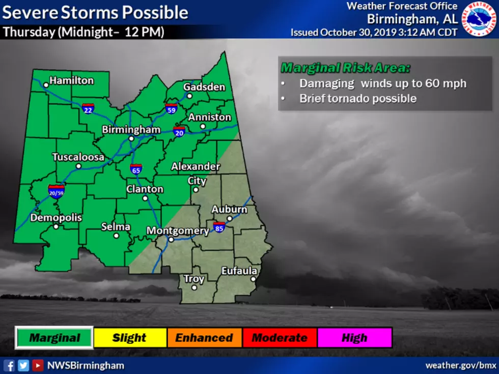
The National Weather Service has a hazardous weather outlook for late tonight (close to Midnight) into tomorrow. This includes a marginal risk of severe storms across our various listening areas. The timeline is Thursday between Midnight and Noon. There is the potential for damaging winds up to 60 mpg, and a low risk for a brief tornado is possible. This hazardous weather outlook is for the following counties: Marion-Lamar-Fayette-Winston-Walker-Blount-Etowah-Calhoun-Cherokee-Cleburne-Pickens-Tuscaloosa-Jefferson-Shelby-St. Clair-Talladega-Clay-Randolph-Sumter-Greene-Hale-Perry-Bibb-Chilton-Coosa-Tallapoosa-Chambers-Marengo-Dallas-Autauga-Lowndes-Elmore-Montgomery-Macon-Bullock-Lee-Russell-Pike-Barbour.
Also, prepare for old temperatures coming our way on Thursday.
Have a great Wednesday! Be sure to follow me on Instagram at @MaryKRadio
More From ME TV FM 97.5