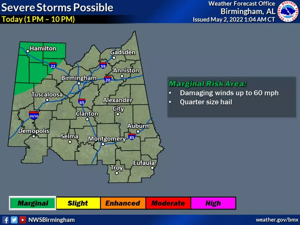
Marginal Risk of Severe Weather Introduced for Northwest Central Alabama
Update:
The National Weather Service in Birmingham has issued a

* Severe Thunderstorm Warning for...
  Northwestern Tuscaloosa County in west central Alabama...
  Northeastern Pickens County in west central Alabama...
  Southwestern Fayette County in west central Alabama...
  Southern Lamar County in west central Alabama...
We have had a stretch of time without severe weather. Please don’t let down your guard and continue to remain weather aware. Today, Monday, May 2nd there is a chance for “scattered showers and thunderstorms will develop this afternoon and evening, a couple of which could be severe,” said the National Weather Service in Birmingham.
Where:
Northwest portions of Central Alabama
When:
Today (1 PM to 10 PM)
Threats:
Damaging winds up to 60 mph
Quarter size hail

James Spann, ABC 33/40, and Townsquare Media Tuscaloosa Chief Meteorologist said that “ a few widely scattered showers and storms will likely form during the afternoon and evening hours; odds of any one spot getting wet today are 20-30 percent. SPC has defined a low end "marginal risk" (level 1/5) for the northwest corner of the state where a few storms could produce hail and gusty winds.”
Developing Story on Possible Severe Weather Later This Week
We are several days away from the potential for severe weather. We are closely monitoring a system that could impact our listening areas (West Alabama). Please remember this information could certainly change due to weather conditions.
Spann noted that “the higher severe weather probabilities are to the west Thursday, across the Mid-South, including places like Memphis. But, storms could produce strong winds and hail as they move through Alabama. Maybe a brief, isolated tornado or two. The core window for strong to severe thunderstorms for Alabama will come from about 12 midnight Thursday night through Noon Friday.”
(Source) For more from the National Weather Service Birmingham, click here. Click here to follow the Facebook Page for James Spann.
This Rare French Style Georgia Home is Straight Out of 'Bridgerton'
Rare Island Home Showcases Panoramic Views of Alabama’s Guntersville Lake
Look Through This Custom Built Home on Alabama’s Logan Martin Lake
More From ME TV FM 97.5


